Toulouse subway map is a diagram showing the lines and stations of the Toulouse Ⓜ subway. They run through the beautiful city of Toulouse and make it easy to reach the most famous buildings in the city. The subway lines are identified by distinct colors for better legibility of your route. Some lines allow you to connect to other forms of public transportation such as trams or buses. There's nothing like visiting the city of Toulouse without being stuck in traffic. Less polluting, less tiring, opt for the subway and other public transportation. It is now an essential means of transportation for travel in a large city like Toulouse.
The Toulouse Metro consists of two main metro lines crossing the pink city from end to end, covering over 28 kilometers of tracks. The Toulouse metro has 38 stations spread across the 2 lines A and B. You can travel with the first metro from 5:15 am or catch the last metro at midnight, extending to 3 am on Fridays and Saturdays.
To discover the tourist sites closest to your metro train, feel free to get the Routard guide.
Line A
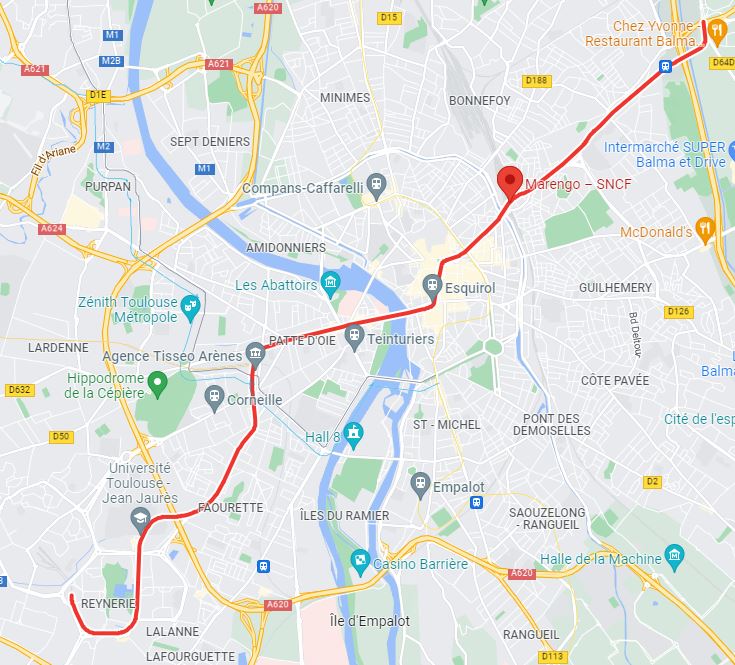
Toulouse Metro Line A has 18 stations connecting Basso Cambo to Balma - Gramont. The plan of Line A is represented in Red. Basso Cambo metro station is the terminus of Line A. Arène is the 8th station that allows you to connect to the TER and McDonald's. Choose St Cyprien - République station if you want to go to Joseph Ducuing Hospital. You can change lines or metro trains at Jean Jaures station to switch to Line B. You will then pass over the Pont Neuf. The platforms of Line A are clean. Marengo metro station will allow you to reach the SNCF train station.
Representation in Google Map of Toulouse Metro Line A
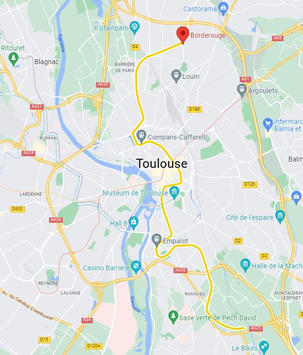
Toulouse Metro Line B connects Borderouge to Ramonville. The plan of Line B is represented in Yellow. This metro line crosses Toulouse from North to South.
Representation in Google Map of Toulouse Metro Line B
The subway, short for "metropolitan railway," is a form of urban public transportation that allows you to travel through different metropolitan areas around the world without driving. No more endless traffic jams during rush hour. Taking public transportation or taking the subway has become very easy today. La carte de métro est téléchargeable ou accessible en ligne. The subway ticket can be purchased at the counter or with your phone. The price of tickets is more affordable than a taxi and more environmentally friendly.